Skip to content
icon-X
Close menu
The Collection
Ireland
Best Sellers
By County
Dramatic Scenes
Peaceful Images
Photographs from "The Irish Light"
Photographs from "Atlantic Light"
Photographs from "The Skelligs"
Around the World
Iceland
Svalbard
Greenland
Antarctica & South Georgia
Scotland
Faroe Islands
Astrophotography
The Wonders of the Universe
Gifts & Books
Books
Gift Cards
Phone Cases & Mugs
About
Blog
Shipping
Contact
Log in
instagram
Instagram
Facebook
LinkedIn
Cart
icon-X
Close cart
Your cart is currently empty.
instagram
Instagram
Facebook
LinkedIn
Currency
Ireland (EUR €)
Afghanistan (AFN ؋)
Åland Islands (EUR €)
Albania (ALL L)
Algeria (DZD د.ج)
Andorra (EUR €)
Angola (EUR €)
Anguilla (XCD $)
Antigua & Barbuda (XCD $)
Argentina (EUR €)
Armenia (AMD դր.)
Aruba (AWG ƒ)
Ascension Island (SHP £)
Australia (AUD $)
Austria (EUR €)
Azerbaijan (AZN ₼)
Bahamas (BSD $)
Bahrain (EUR €)
Bangladesh (BDT ৳)
Barbados (BBD $)
Belarus (EUR €)
Belgium (EUR €)
Belize (BZD $)
Benin (XOF Fr)
Bermuda (USD $)
Bhutan (EUR €)
Bolivia (BOB Bs.)
Bosnia & Herzegovina (BAM КМ)
Botswana (BWP P)
Brazil (EUR €)
British Indian Ocean Territory (USD $)
British Virgin Islands (USD $)
Brunei (BND $)
Bulgaria (BGN лв.)
Burkina Faso (XOF Fr)
Burundi (BIF Fr)
Cambodia (KHR ៛)
Cameroon (XAF CFA)
Canada (CAD $)
Cape Verde (CVE $)
Caribbean Netherlands (USD $)
Cayman Islands (KYD $)
Central African Republic (XAF CFA)
Chad (XAF CFA)
Chile (EUR €)
China (CNY ¥)
Christmas Island (AUD $)
Cocos (Keeling) Islands (AUD $)
Colombia (EUR €)
Comoros (KMF Fr)
Congo - Brazzaville (XAF CFA)
Congo - Kinshasa (CDF Fr)
Cook Islands (NZD $)
Costa Rica (CRC ₡)
Côte d’Ivoire (XOF Fr)
Croatia (EUR €)
Curaçao (ANG ƒ)
Cyprus (EUR €)
Czechia (CZK Kč)
Denmark (DKK kr.)
Djibouti (DJF Fdj)
Dominica (XCD $)
Dominican Republic (DOP $)
Ecuador (USD $)
Egypt (EGP ج.م)
El Salvador (USD $)
Equatorial Guinea (XAF CFA)
Eritrea (EUR €)
Estonia (EUR €)
Eswatini (EUR €)
Ethiopia (ETB Br)
Falkland Islands (FKP £)
Faroe Islands (DKK kr.)
Fiji (FJD $)
Finland (EUR €)
France (EUR €)
French Guiana (EUR €)
French Polynesia (XPF Fr)
French Southern Territories (EUR €)
Gabon (XOF Fr)
Gambia (GMD D)
Georgia (EUR €)
Germany (EUR €)
Ghana (EUR €)
Gibraltar (GBP £)
Greece (EUR €)
Greenland (DKK kr.)
Grenada (XCD $)
Guadeloupe (EUR €)
Guatemala (GTQ Q)
Guernsey (GBP £)
Guinea (GNF Fr)
Guinea-Bissau (XOF Fr)
Guyana (GYD $)
Haiti (EUR €)
Honduras (HNL L)
Hong Kong SAR (HKD $)
Hungary (HUF Ft)
Iceland (ISK kr)
India (INR ₹)
Indonesia (IDR Rp)
Iraq (EUR €)
Ireland (EUR €)
Isle of Man (GBP £)
Israel (ILS ₪)
Italy (EUR €)
Jamaica (JMD $)
Japan (JPY ¥)
Jersey (EUR €)
Jordan (EUR €)
Kazakhstan (KZT ₸)
Kenya (KES KSh)
Kiribati (EUR €)
Kosovo (EUR €)
Kuwait (EUR €)
Kyrgyzstan (KGS som)
Laos (LAK ₭)
Latvia (EUR €)
Lebanon (LBP ل.ل)
Lesotho (EUR €)
Liberia (EUR €)
Libya (EUR €)
Liechtenstein (CHF CHF)
Lithuania (EUR €)
Luxembourg (EUR €)
Macao SAR (MOP P)
Madagascar (EUR €)
Malawi (MWK MK)
Malaysia (MYR RM)
Maldives (MVR MVR)
Mali (XOF Fr)
Malta (EUR €)
Martinique (EUR €)
Mauritania (EUR €)
Mauritius (MUR ₨)
Mayotte (EUR €)
Mexico (EUR €)
Moldova (MDL L)
Monaco (EUR €)
Mongolia (MNT ₮)
Montenegro (EUR €)
Montserrat (XCD $)
Morocco (MAD د.م.)
Mozambique (EUR €)
Myanmar (Burma) (MMK K)
Namibia (EUR €)
Nauru (AUD $)
Nepal (NPR Rs.)
Netherlands (EUR €)
New Caledonia (XPF Fr)
New Zealand (NZD $)
Nicaragua (NIO C$)
Niger (XOF Fr)
Nigeria (NGN ₦)
Niue (NZD $)
Norfolk Island (AUD $)
North Macedonia (MKD ден)
Norway (EUR €)
Oman (EUR €)
Pakistan (PKR ₨)
Palestinian Territories (ILS ₪)
Panama (USD $)
Papua New Guinea (PGK K)
Paraguay (PYG ₲)
Peru (PEN S/)
Philippines (PHP ₱)
Pitcairn Islands (NZD $)
Poland (PLN zł)
Portugal (EUR €)
Qatar (QAR ر.ق)
Réunion (EUR €)
Romania (RON Lei)
Russia (EUR €)
Rwanda (RWF FRw)
Samoa (WST T)
San Marino (EUR €)
São Tomé & Príncipe (STD Db)
Saudi Arabia (SAR ر.س)
Senegal (XOF Fr)
Serbia (RSD РСД)
Seychelles (EUR €)
Sierra Leone (SLL Le)
Singapore (SGD $)
Sint Maarten (ANG ƒ)
Slovakia (EUR €)
Slovenia (EUR €)
Solomon Islands (SBD $)
Somalia (EUR €)
South Africa (EUR €)
South Georgia & South Sandwich Islands (GBP £)
South Korea (KRW ₩)
South Sudan (EUR €)
Spain (EUR €)
Sri Lanka (LKR ₨)
St. Barthélemy (EUR €)
St. Helena (SHP £)
St. Kitts & Nevis (XCD $)
St. Lucia (XCD $)
St. Martin (EUR €)
St. Pierre & Miquelon (EUR €)
St. Vincent & Grenadines (XCD $)
Sudan (EUR €)
Suriname (EUR €)
Svalbard & Jan Mayen (EUR €)
Sweden (SEK kr)
Switzerland (CHF CHF)
Taiwan (TWD $)
Tajikistan (TJS ЅМ)
Tanzania (TZS Sh)
Thailand (THB ฿)
Timor-Leste (USD $)
Togo (XOF Fr)
Tokelau (NZD $)
Tonga (TOP T$)
Trinidad & Tobago (TTD $)
Tristan da Cunha (GBP £)
Tunisia (EUR €)
Türkiye (EUR €)
Turkmenistan (EUR €)
Turks & Caicos Islands (USD $)
Tuvalu (AUD $)
U.S. Outlying Islands (USD $)
Uganda (UGX USh)
Ukraine (UAH ₴)
United Arab Emirates (AED د.إ)
United Kingdom (GBP £)
United States (USD $)
Uruguay (UYU $U)
Uzbekistan (UZS so'm)
Vanuatu (VUV Vt)
Vatican City (EUR €)
Venezuela (USD $)
Vietnam (VND ₫)
Wallis & Futuna (XPF Fr)
Western Sahara (MAD د.م.)
Yemen (YER ﷼)
Zambia (EUR €)
Zimbabwe (USD $)
The Collection
Ireland
Best Sellers
By County
Dramatic Scenes
Peaceful Images
Photographs from "The Irish Light"
Photographs from "Atlantic Light"
Photographs from "The Skelligs"
Around the World
Iceland
Svalbard
Greenland
Antarctica & South Georgia
Scotland
Faroe Islands
Astrophotography
The Wonders of the Universe
Gifts & Books
Books
Gift Cards
Phone Cases & Mugs
About
Blog
Shipping
Contact
account
Log in
icon-search
Search
icon-hamburger
Site navigation
icon-bag-minimal
Cart
Search
Search
Pause slideshow
Play slideshow
beautiful photography of ireland, delivered to your door!
Home
/
Collections
/
Kerry
/
Panoramic
Kerry
More filters
aerials
(13)
aurora
(1)
black & white
(2)
castles
(2)
cliffs
(7)
coast
(35)
Dingle
(1)
Ireland
(55)
islands
(27)
Kerry
(55)
lakes
(15)
lighthouses
(5)
long exposure
(9)
mountains
(33)
nocturnes
(4)
panoramic
(55)
rainbows
(1)
rivers
(2)
ruins
(7)
snow
(2)
sunset/sunrise
(25)
trees
(2)
waterfalls
(1)
wildlife
(2)
Filter
icon-X
Close menu
More filters
aerials
(13)
aurora
(1)
black & white
(2)
castles
(2)
cliffs
(7)
coast
(35)
Dingle
(1)
Ireland
(55)
islands
(27)
Kerry
(55)
lakes
(15)
lighthouses
(5)
long exposure
(9)
mountains
(33)
nocturnes
(4)
panoramic
(55)
rainbows
(1)
rivers
(2)
ruins
(7)
snow
(2)
sunset/sunrise
(25)
trees
(2)
waterfalls
(1)
wildlife
(2)
icon-filter
Filter
55 products
Sort
Sort
Featured
Best selling
Alphabetically, A-Z
Alphabetically, Z-A
Price, low to high
Price, high to low
Date, old to new
Date, new to old
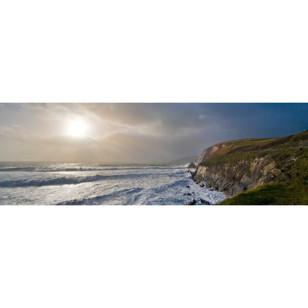
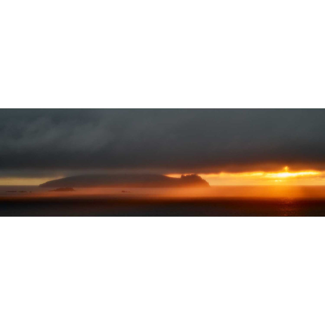
Storm, Slea Head, Co. Kerry
from
€75.00
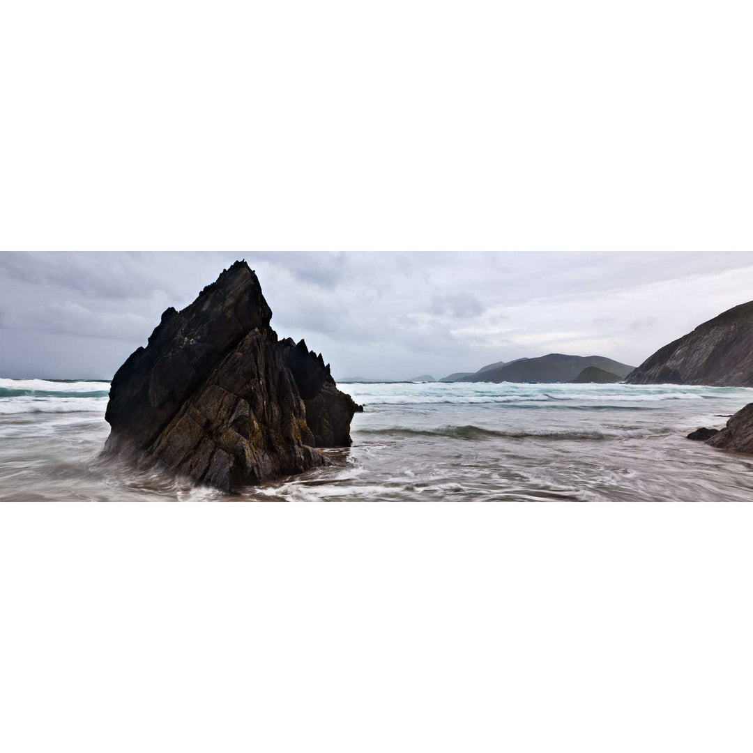
Coumeenole Beach Panoramic, Dingle, Co. Kerry
from
€75.00
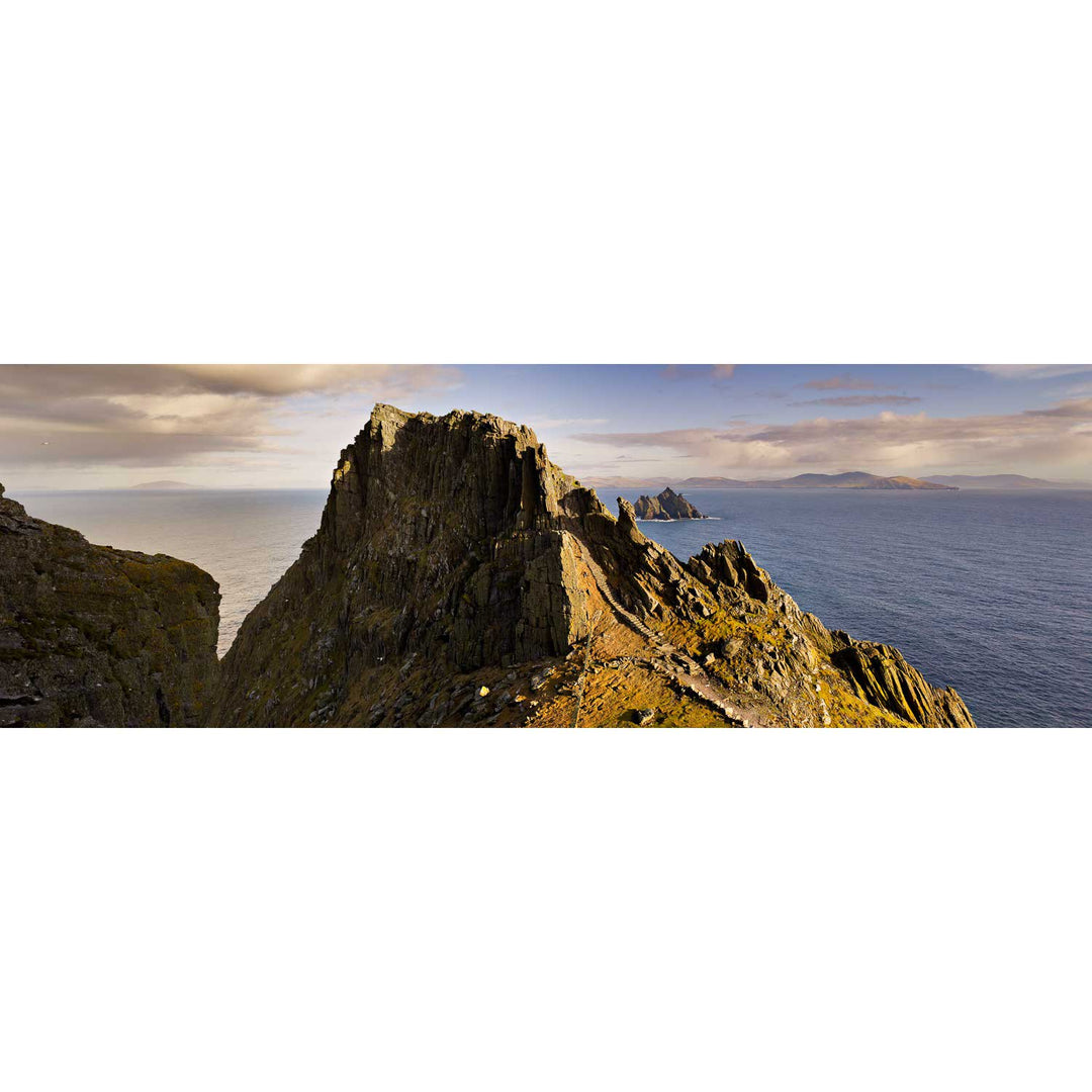
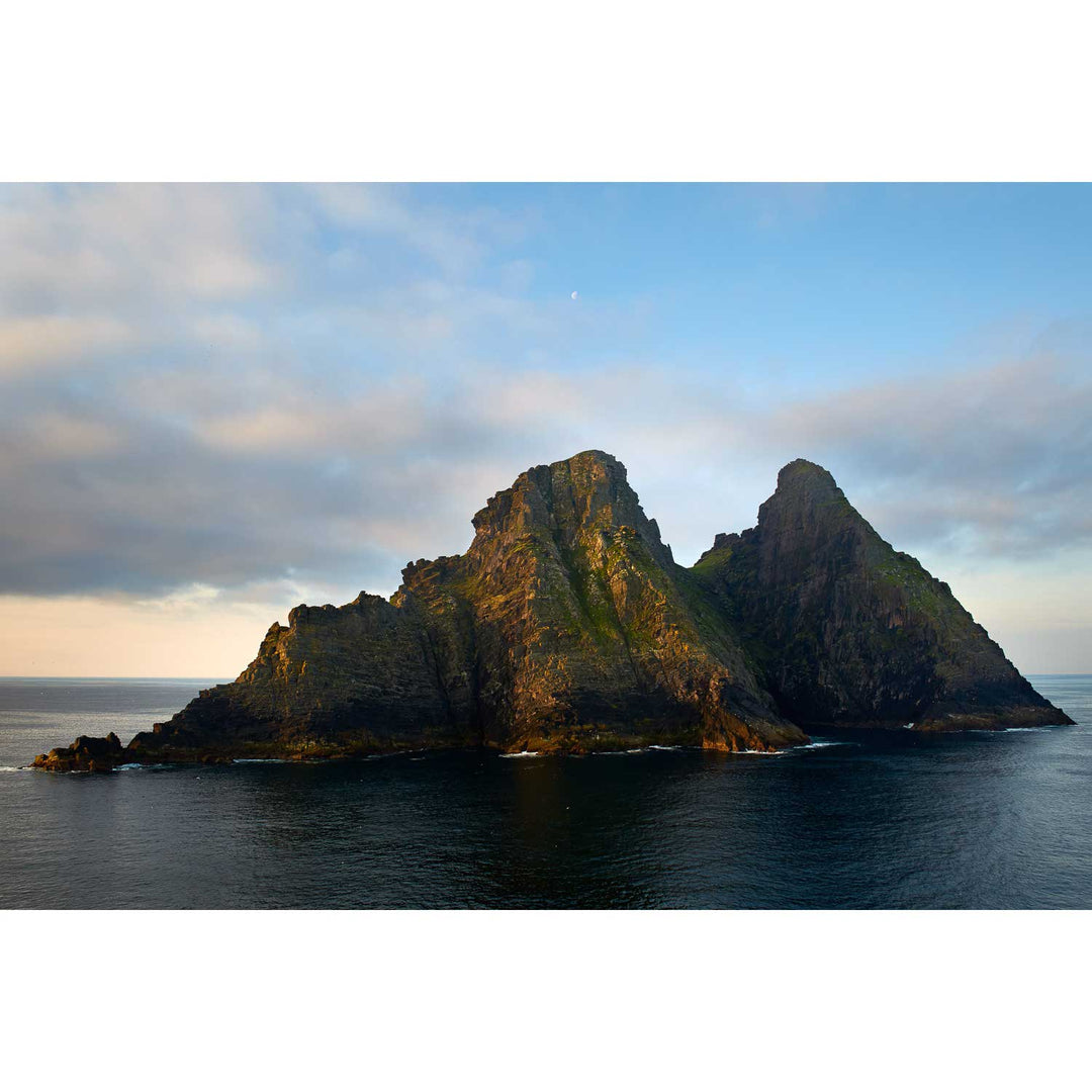
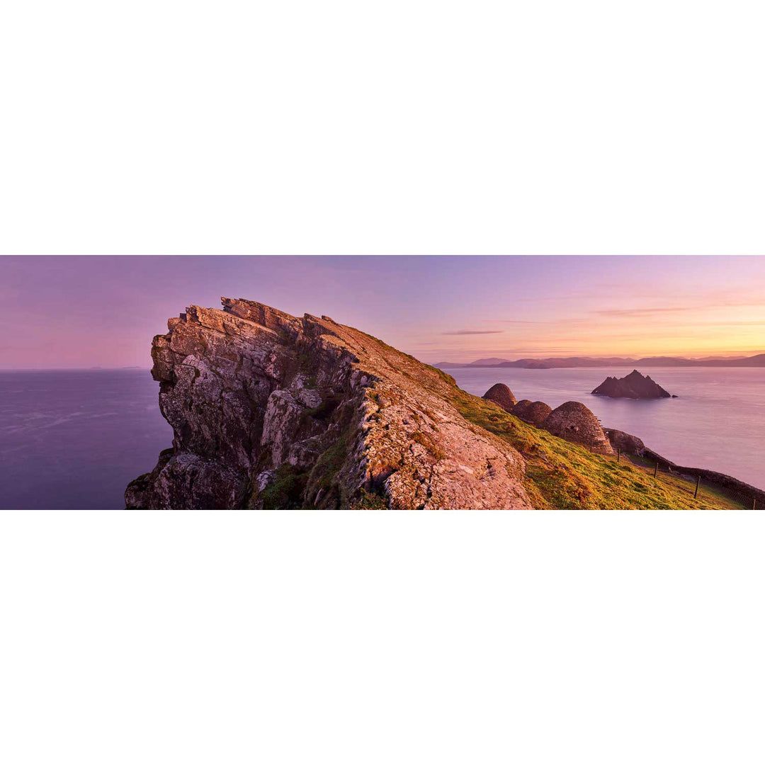
North Peak, Skellig Michael, Co. Kerry
from
€75.00
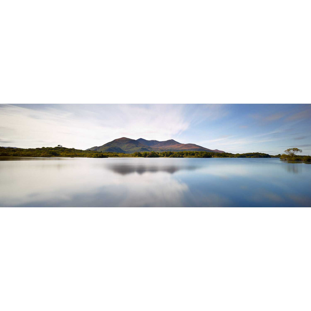
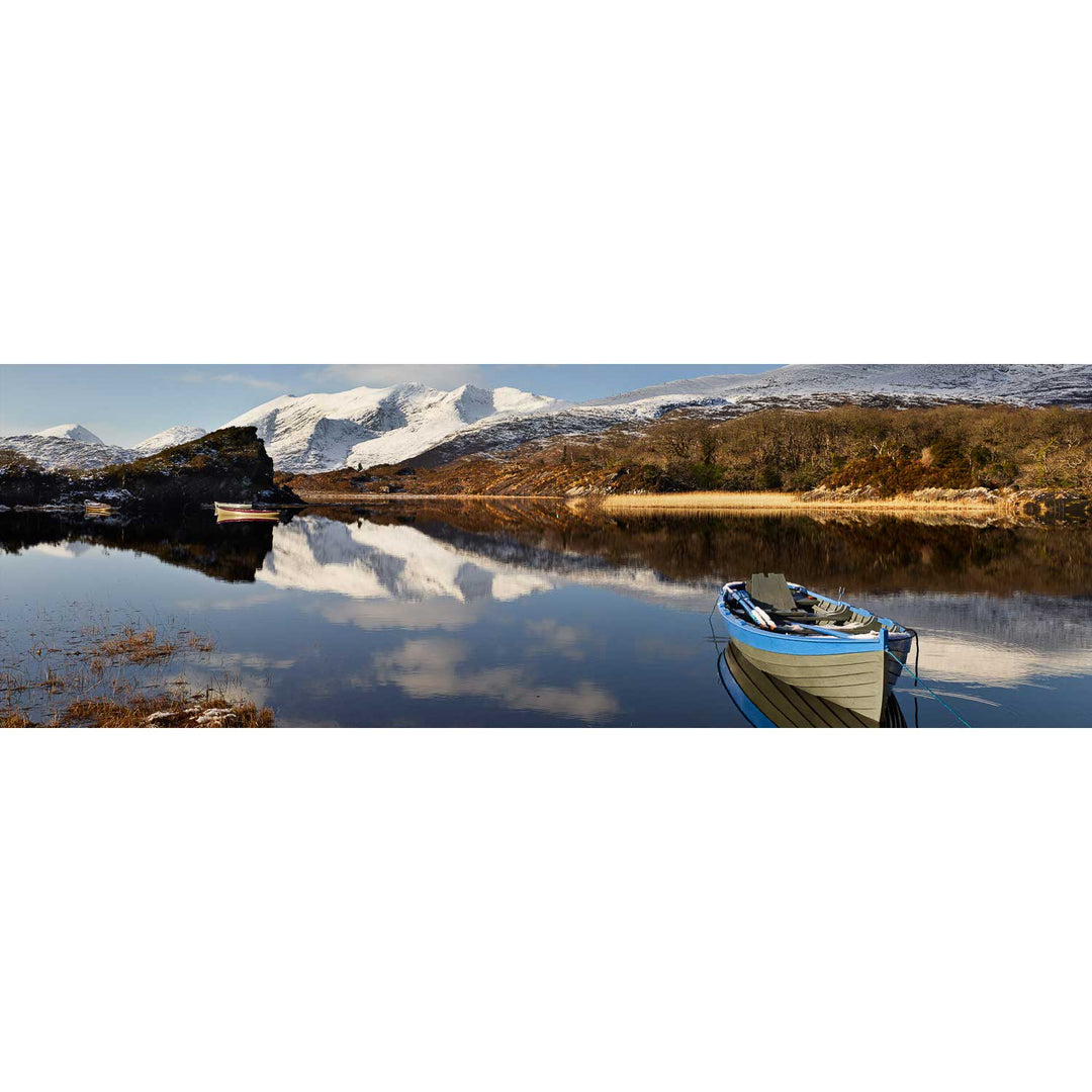
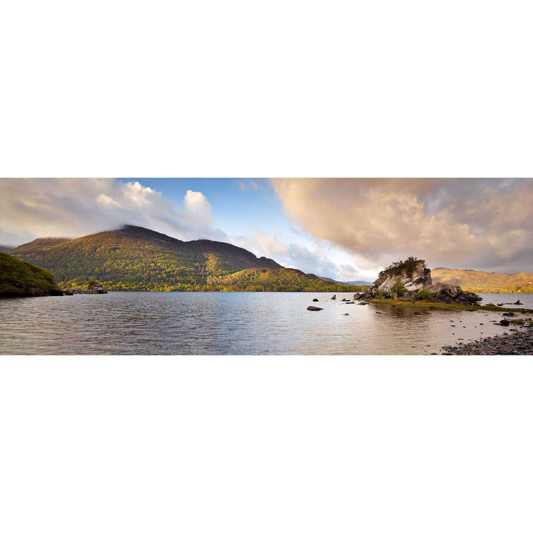
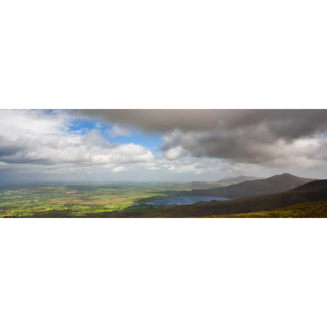
Summer, Lough Leane, Co. Kerry
from
€75.00
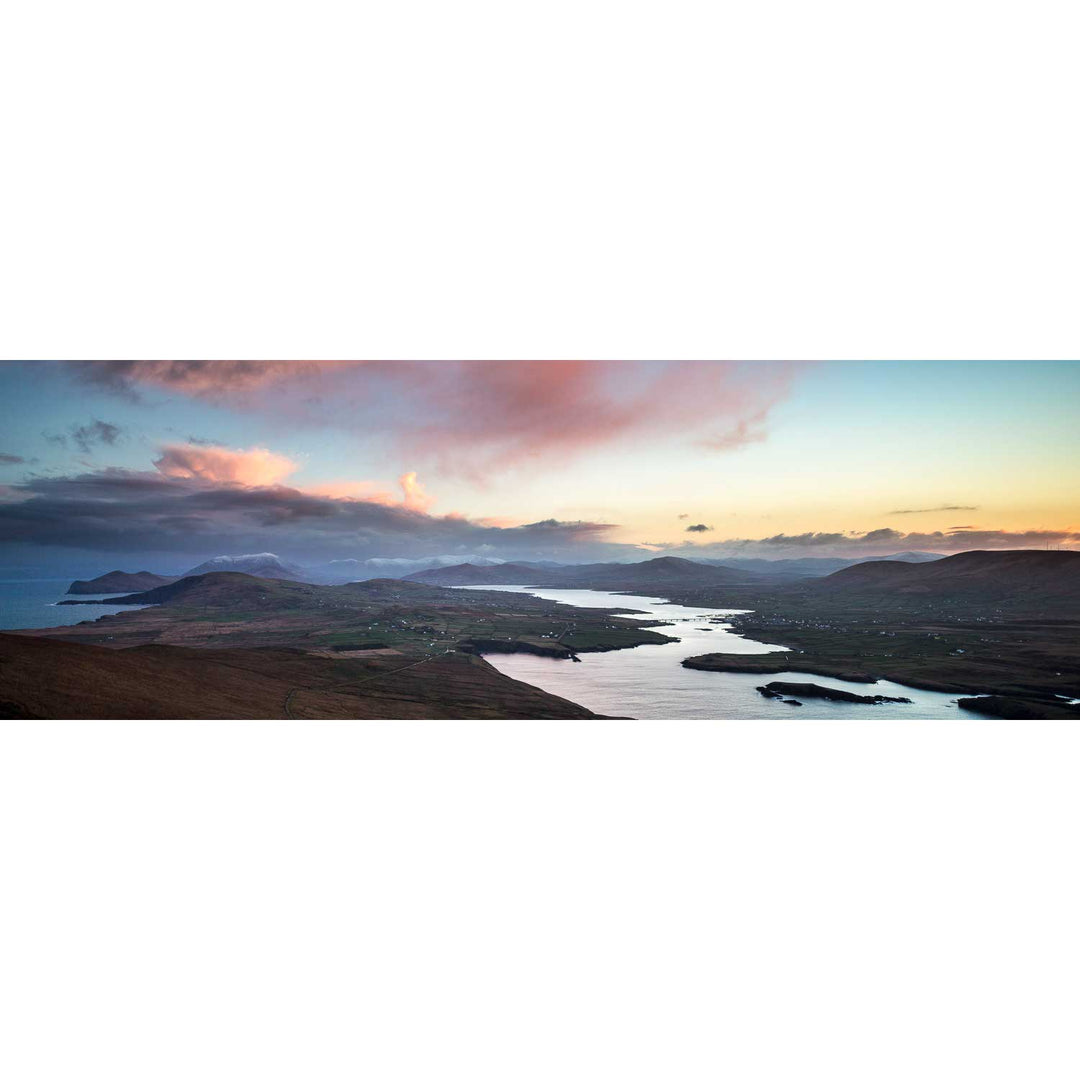
Valentia Sound, Co. Kerry
from
€75.00
Upper Lake Panoramic, Co. Kerry
from
€75.00
Geokaun Mountain Panoramic, Co. Kerry
from
€75.00
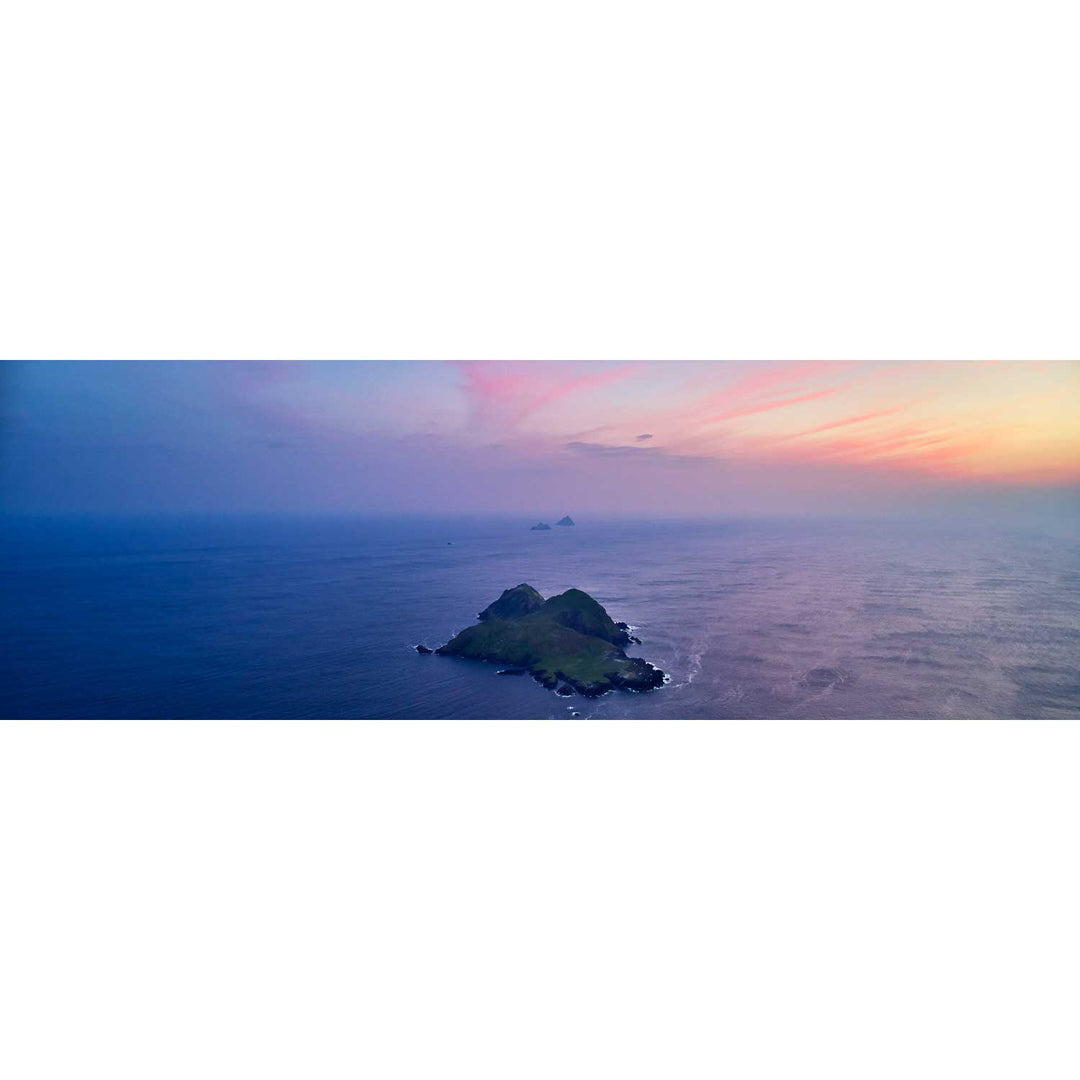
Puffin Island and the Skelligs, Kerry
from
€75.00
Skellig Michael from the North, Kerry
from
€75.00
Skellig Michael with Brooding Clouds, Kerry
from
€75.00
The Sleeping Giant, Dingle, Kerry
from
€75.00
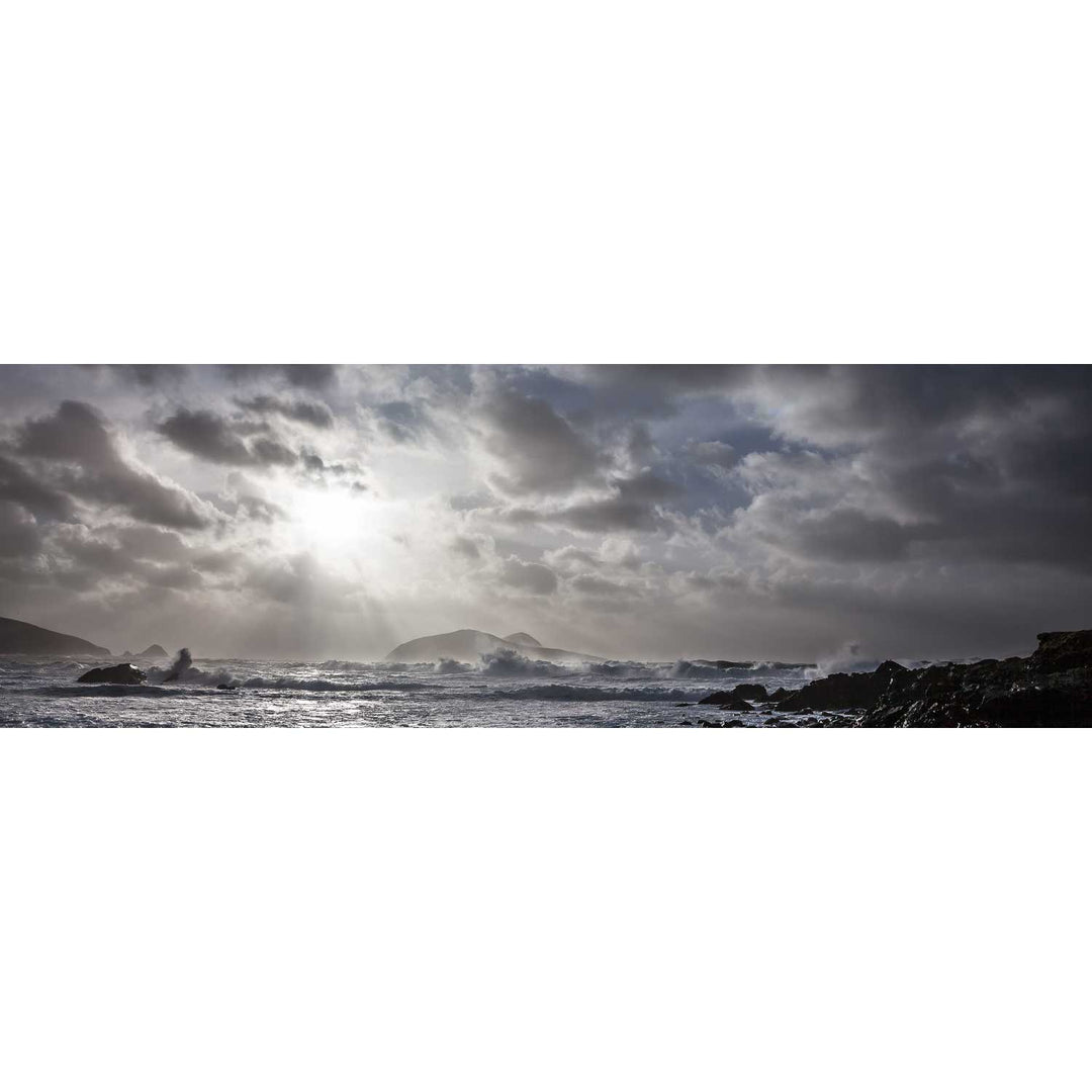
Storm, the Great Blasket, Dingle, Co. Kerry
from
€75.00
North Peak Ridge Pano, Skellig Michael, Kerry
from
€75.00
Lough Leane and the Reeks, Killarney, Co. Kerry
from
€75.00
Light the Way, Skellig Michael, Kerry
from
€75.00
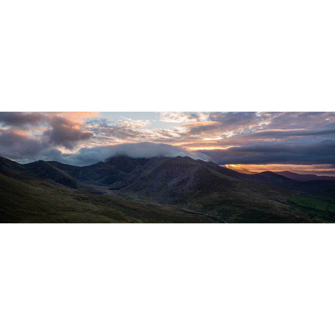
Bridia Valley, Co. Kerry
from
€75.00
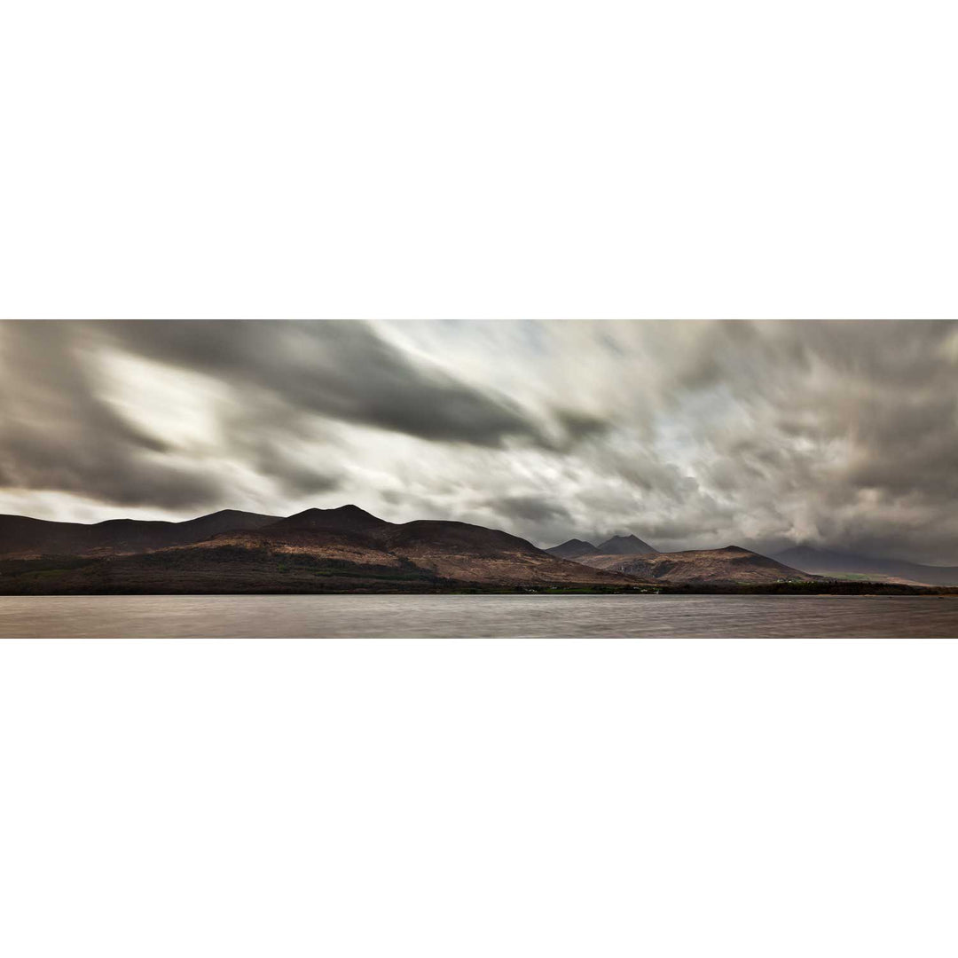
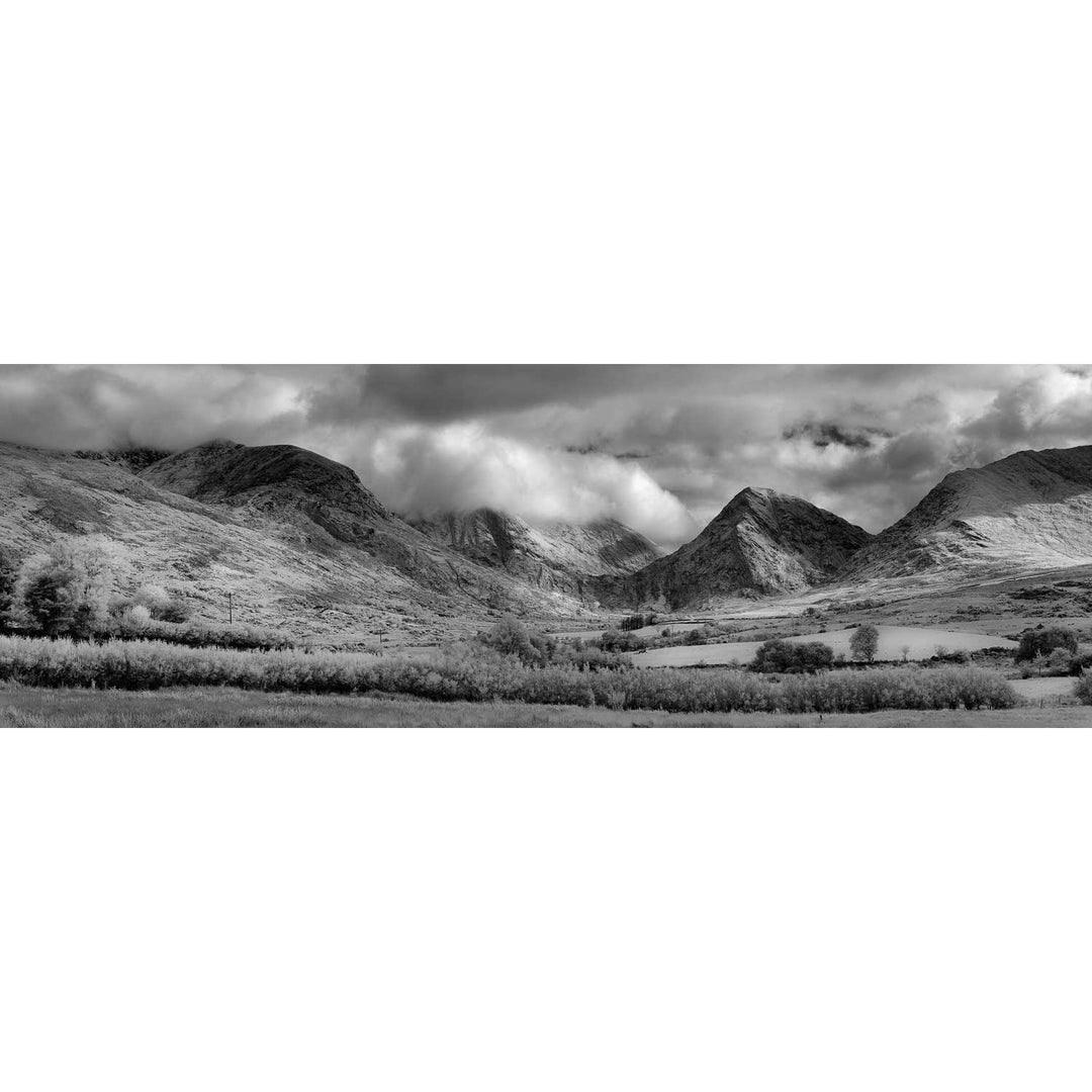
The Macgillycuddy's Reeks, Co. Kerry
from
€75.00
Nocturne, Skellig Michael Lighthouse, Panoramic, Co. Kerry
from
€75.00
Colleen Bawn Rock, Killarney National Park, Co. Kerry
from
€75.00
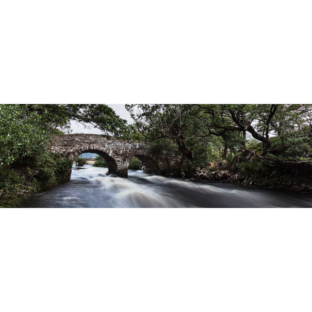
The Meeting of the Waters Panoramic, Killarney, Co. Kerry
from
€75.00
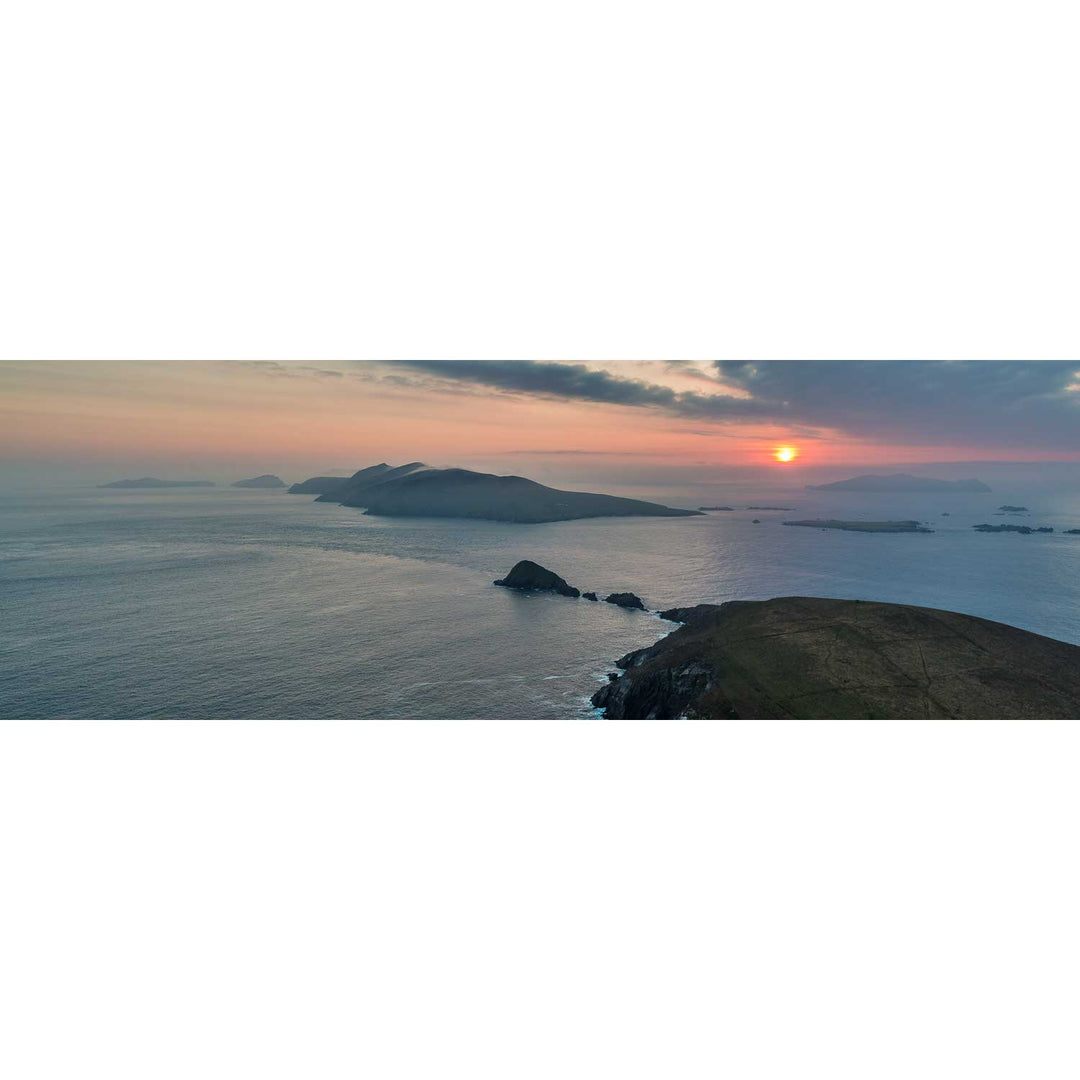
Dunmore Head at Sunset, Dingle, Co. Kerry
from
€75.00
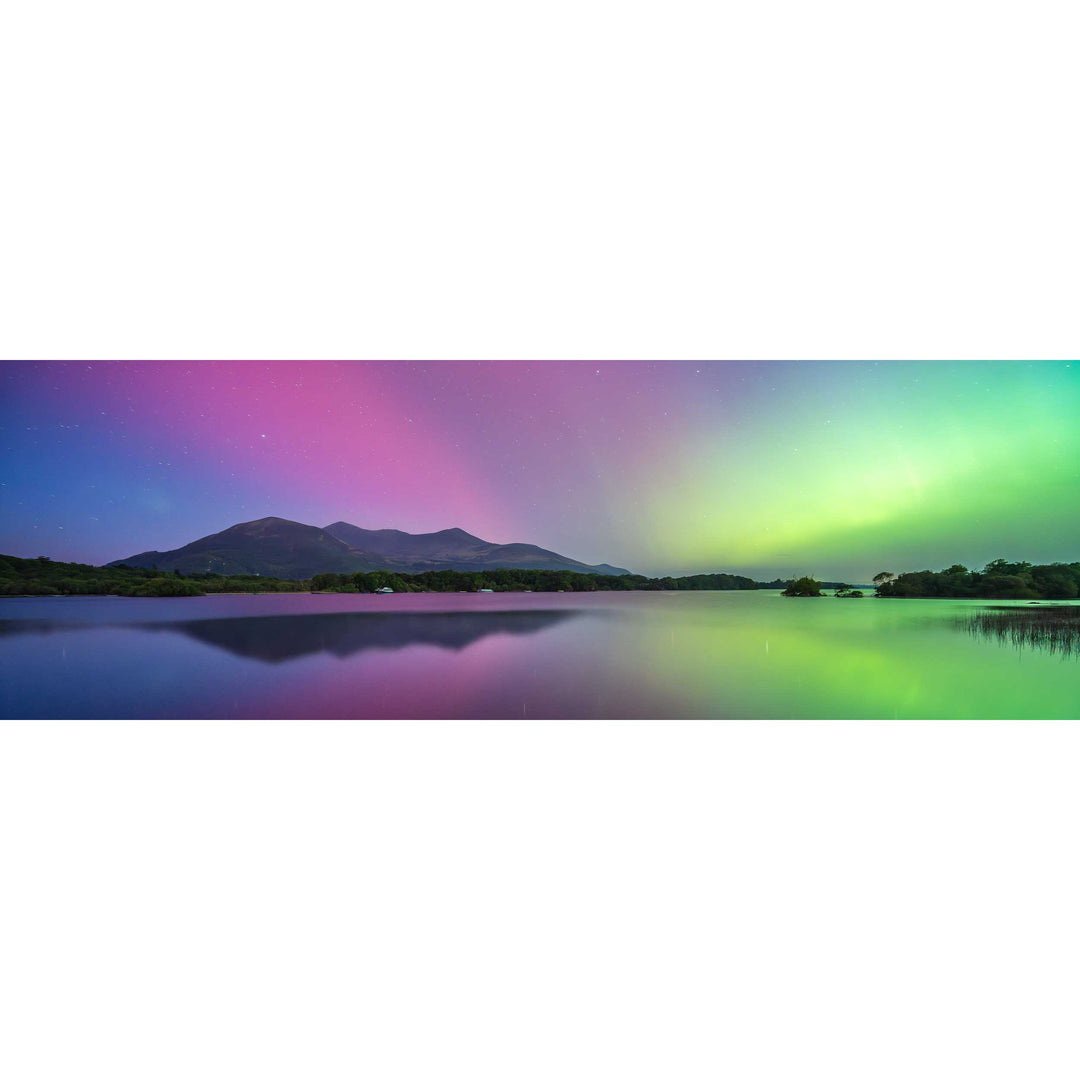
Lough Leane under the Aurora, Killarney, Kerry
from
€75.00
Sunrise, the Conor Pass, Dingle, Co. Kerry
from
€75.00
Cummeenduff Lough, Co. Kerry
from
€75.00
Lough Guitane, Co. Kerry
from
€75.00
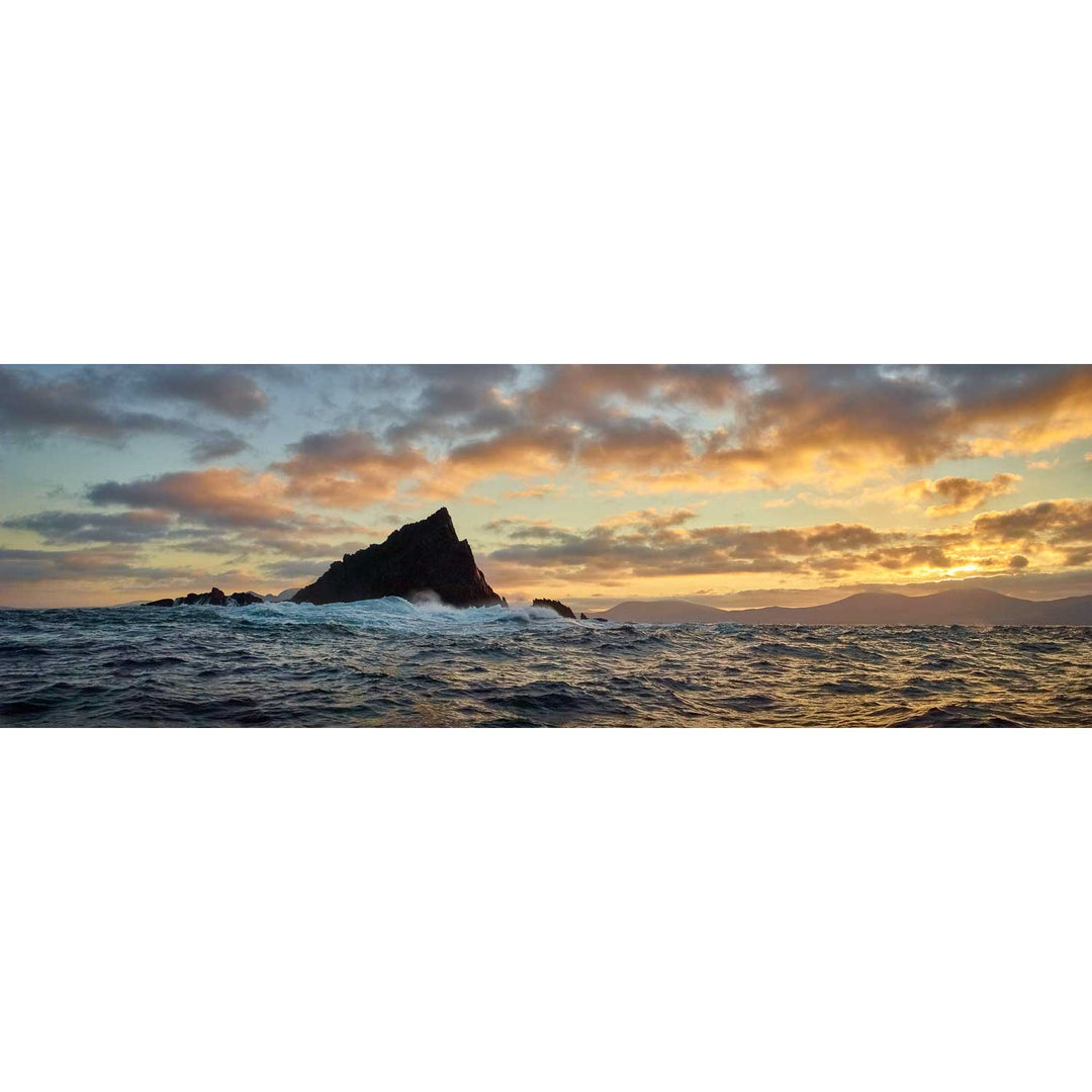
Lemon Rock, Co. Kerry
from
€75.00
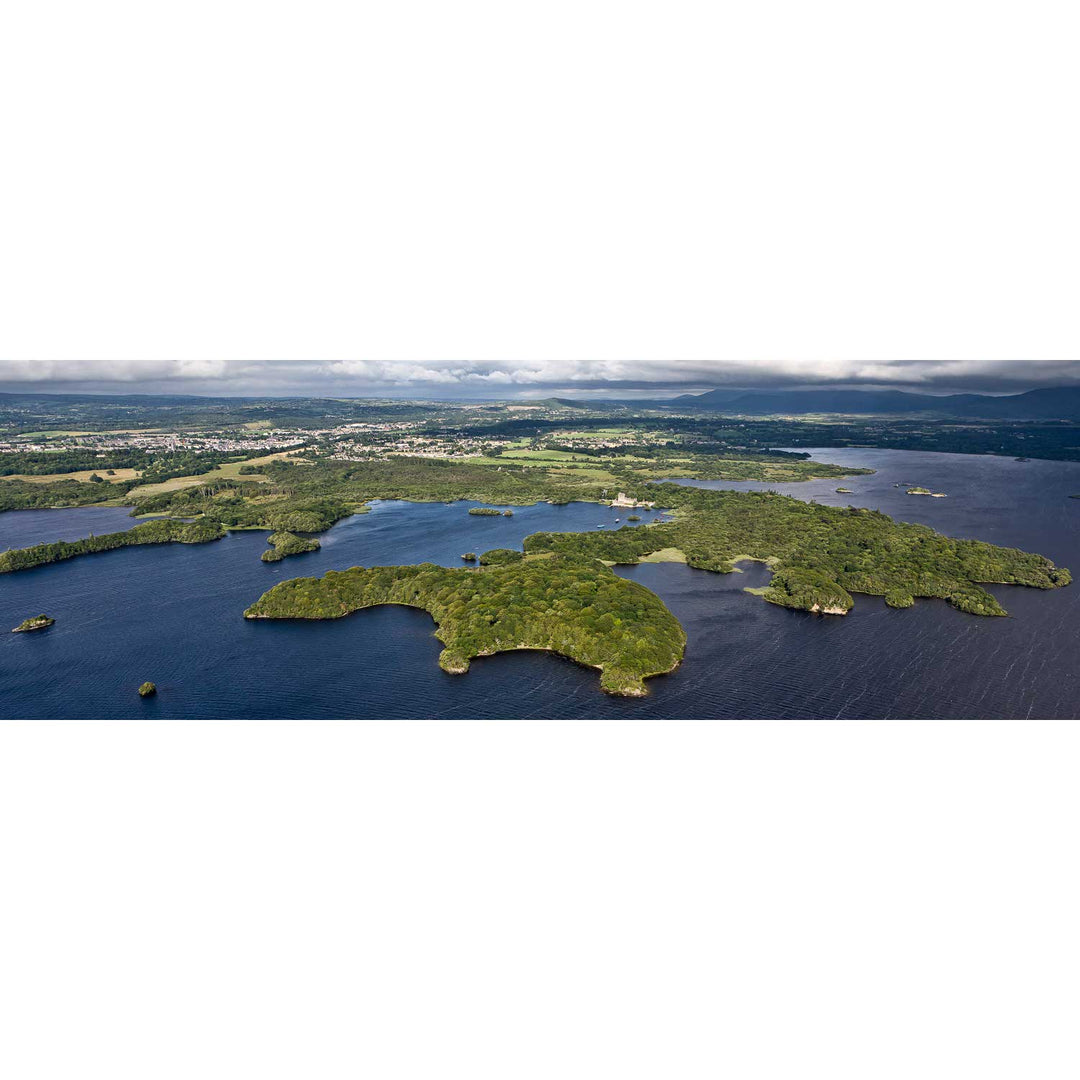
Ross Island, Killarney, Co. Kerry
from
€75.00
Previous
1
2
icon-X
"Close (esc)"
icon-X
icon-chevron
icon-X
Kerry - Peter Cox Photography