


There's no surviving record written by any monk who lived on Skellig Michael. Not a diary, not a letter, not a list of provisions. We know they were there for over six hundred years - from roughly the 6th century to the 12th - but almost everything we understand about their daily lives is inference, drawn from the buildings they left behind and the handful of references in annals kept elsewhere. That silence is part of what makes the place so compelling.

Why Skellig?
The monks who settled on Skellig Michael were ascetics, following in the footsteps of St. Anthony of Egypt who lived around the 3rd century. This branch of early Christian monasticism sought to be closer to God by withdrawing from the world into harsh, isolated conditions. St. Anthony spent his years in the Egyptian desert. The Skellig monks found their desert in the Atlantic Ocean.
It's believed the monastery was founded by followers of St. Fionán, though this is tradition rather than documented fact. The island was dedicated to St. Michael - the Archangel associated with high places and the battle between good and evil - sometime between 950 and 1050. The choice of patron saint feels appropriate for a rock rising 218 metres out of the ocean.
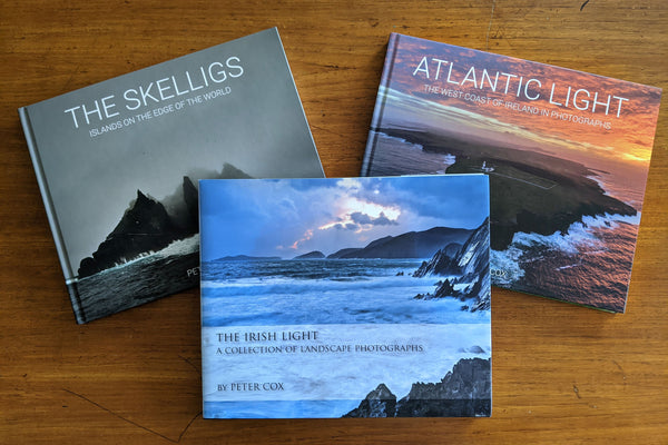
For the monks, Skellig Michael really was the edge of the known world. There was nothing beyond it but open sea, and whatever they imagined lay on the other side of it. The subtitle of my book - 'Islands on the Edge of the World' - isn't poetic licence. It's how they would have understood their position.
What They Built
The island has almost no flat space, so the monks created their own. They built massive terraces with drystone retaining walls - walls that had to hold up entire platforms of rock and soil against the Atlantic winds and the relentless force of gravity. From the sea, this gives the monastery a fortress-like appearance. The engineering is remarkable, not because it's elegant, but because it works. It's still working, over a thousand years later, though it's been subject to extensive conservation by the OPW since the 1980s.
The beehive huts - six intact cells plus a larger oratory - are built using a corbelling technique where each course of stone is set slightly inward from the one below, working up in gradually smaller circles until the roof is closed. Each course is canted outward to shed rainwater, and the result is a structure that's remained watertight for centuries. It's probable that twelve monks and an abbot lived in these cells at any one time. Cell A, the largest, was clearly communal - it has window openings, one focusing on the South Peak and another on the Small Skellig, and is nearly five metres high. Some of the cells have stone pegs projecting from the walls, probably for storage, and Cell F has upright slabs defining a raised section on three sides that may have served as a sleeping platform.
There's no fresh water on the island, so the monks gathered rainwater in channels and grooves carved into the rock, directing it into cisterns beneath the monastery. Three water cisterns have been found within the monastic enclosure, and it's believed these were built before the cells themselves - finding water was a more urgent problem than somewhere to sleep. The system they devised was ingenious: interconnecting basins allowed water to flow from one to the next, with a depression in the first basin to collect silt - a basic but effective filtration system.

Daily Life - What We Can Guess
Without written records, we're left to piece together what life was like from the physical evidence and from what we know about similar communities elsewhere. The monks would have spent their days in prayer, with some time given to study, tending their terraces, and fishing.
The so-called Monk's Garden is probably misnamed. The south-facing terraces that make up the outer enclosure were certainly sheltered enough to grow vegetables - experiments have shown that the micro-climate created by the terracing allowed plants to grow at twice the speed of mainland sites - but excavation of the lower garden revealed the remains of an early cell (Cell G) and paving beneath the soil, suggesting the terraces had other uses at different periods in the monastery's history. It's likely they were cultivated at some stage, but we shouldn't assume it was their primary or only function.
The monks' diet was more varied than you'd expect. The archaeological excavations from 1986 to 2010 recovered the butchered remains of goat, sheep, cattle, pig, and seal. Seven species of fish were identified in the bone assemblage, with sea bream the most common. Manx shearwater and puffin bones were found charred by roasting - they were clearly eating the seabirds as well as their eggs. The monks also gathered seabird eggs from the Small Skellig, and there's evidence of a shelter structure on that island that they probably used during their egg-gathering expeditions. Additional grain was probably brought from the mainland, along with wood and charcoal, since there are no trees on the island. All in all, a richer menu than you'd expect of an ascetic monastic regime.
Weather conditions, especially in winter, would have been brutal. Damp and cold would have been constant companions, and the physical toll of those conditions shows up in the archaeological record. During the excavations, the remains of at least eight individuals were recovered - all either adult males or children between the ages of about nine and eleven. Dated to between the 10th and 13th centuries, these bones weren't found in the cemetery area but near the outside walls of structures throughout the monastery. The graveyard itself - a strange raised rectangular structure studded with crosses, but not large enough to hold more than a few bodies - yielded almost nothing. The acidic conditions on the island had effectively dissolved most of the remains over the centuries.
Of the more intact remains that were found, two stood out: a teenager and a man estimated to be in his forties. The older man's bones showed evidence of powerful musculature - visible in the attachment points where his tendons had gripped the bone - and also of significant arthritis, which is entirely consistent with years of hard labour in cold, damp conditions. It's a small window into a life that was physically demanding in ways we can barely imagine.
The few references that do exist in the historical record paint a picture of a place that attracted the attention of outsiders - not always welcome. The annals record that in 823 the monastery was plundered by Vikings and the abbot, Eitgal, was carried off and died of hunger. They raided again in 838. These weren't casual attacks - the monastery was a known target, and the monks would have needed some form of defence or escape plan.
The South Peak Hermitage
And if the monastery wasn't isolated enough, there was the South Peak. Rising 218 metres from the ocean, this fin of rock held a hermitage even more remote than the monastery itself. Although earlier visitors had noted what appeared to be artificial ledges on the pilgrimage route to the summit, it wasn't until 1990 that researchers removed the covering vegetation and confirmed that the South Peak was the site of a hermitage, likely dating from the 9th century.

Three terraces were identified: the Garden Terrace, the Oratory Terrace, and the Outer Terrace. The Oratory Terrace holds a corbelled oratory measuring roughly 2.3 by 2 metres - barely big enough for one person - with the remains of an altar against the east wall. Two small interconnected basins sit beside it, collecting rainwater channelled down from the near-vertical rock faces above. The monks had cut steps up through a cleft in the rock known as the Needle's Eye to reach these terraces. It would test anyone's head for heights.
The hermitage may have served more than one purpose. Access to the South Peak is via a route so narrow and exposed that a single person stationed at the Needle's Eye, with nothing more than a hoard of rocks to throw, could hold off an army. After repeated Viking raids on the monastery, it's not difficult to imagine the hermitage doubling as a redoubt - a last-resort defensive position where the monks could retreat and wait out an attack. Whether it was conceived with that purpose in mind or simply proved useful in a crisis, the geography makes the argument for you.
We can also imagine a lone hermit choosing to withdraw even from the small community of the monastery, climbing to this near-vertical perch to live in conditions that are difficult to comprehend by modern standards. What drove someone to do that? We'll never know. The monks left no explanation, and the rock isn't talking.
Why They Left
A change in climate around the 13th century that probably brought stormier winter conditions, combined with a shift in the Irish Church towards a more centralised structure, spelled the end of Skellig as a permanent establishment. The community appears to have moved to Ballinskelligs on the mainland, where the Augustinian Canons founded a new priory. Skellig itself was probably still used during the summer months for a time, and it continued to serve as a place of pilgrimage for centuries afterwards.
The Pilgrimage
After the monks left, Skellig Michael entered a new phase as one of Ireland's most important penitential stations. By the early 16th century it was listed in the register of Archbishop Dowdall of Armagh as a major place of pilgrimage, and accounts from the 18th century describe pilgrims coming from all over Ireland and from continental Europe at Easter to complete the stations. William Tirry, Bishop of Cork from 1623 to 1645, recorded a pilgrimage to Skellig as one of the most significant events of his life.
The pilgrimage route went far beyond the monastery. Pilgrims would complete various stations of the cross at specific points on the island before climbing to the South Peak - squeezing through the Needle's Eye, crossing the Stone of Pain (twelve feet of smooth, sloping rock with only a few scant foot-holds cut into it), and ultimately shuffling out astride a knife-edge ridge known as the Spit to kiss a cross-inscribed slab perched at the very end. This was something between devotion and a dare. Charles Smith, writing in 1756, noted that some pilgrims had fallen to their deaths attempting it, and that the enthusiasm for the more dangerous stations had cooled considerably in recent decades. The slab itself disappeared in the mid-1970s, probably lost to the elements - divers searched Blue Cove directly underneath, but no trace was ever found.
It's worth noting that this tradition of penitential pilgrimage has a long parallel in Irish tourism. Many of Ireland's most visited destinations - Glendalough, Croagh Patrick, Lough Derg, Clonmacnoise - became places that people knew about and travelled to precisely because they were pilgrimage sites first. The Augustinian Canons actively promoted established pilgrimage destinations like Skellig and Glendalough from the 12th century onward, and the infrastructure that grew up around these routes - the boatmen, the guides, the accommodation - laid the foundations for the tourism industry that followed centuries later. When modern visitors climb the 618 steps to the monastery, they're walking in the footsteps of pilgrims who made the same climb for rather different reasons.
What Remains

The monastery that the monks left behind is one of the best-preserved examples of early Christian settlement in Europe, and it earned UNESCO World Heritage status in 1996. The OPW has been carrying out conservation and archaeological work since 1978, with major excavations from 1986 to 2010 uncovering a detailed picture of how the monastery was constructed and evolved over time.
Standing in the monastery today, you're in a space that hasn't fundamentally changed in a thousand years. The same stone walls, the same views, the same wind. The monks who lived here would recognise it immediately. That continuity - that sense of being in exactly the same place someone stood in the 7th century - is something you don't experience in many places on earth.


Leave a comment