




The Beara Peninsula: The Healy Pass, Allihies, Dursey and the Bull Rock
If you drive west out of Glengarriff on the road that hugs the shore, you're on the Beara Peninsula within a mile or two. It's a long finger of mountain and rock running out into the Atlantic, with Bantry Bay along the southern side and the Kenmare River along the northern, and the Caha and Slieve Miskish ranges filling most of what's in between. The county boundary runs down the length of it, so the peninsula is split between Cork and Kerry, and you can cross from one county into the other and back again in an afternoon without ever leaving the same strip of land.
Beara gets less attention than its neighbours. There's a version of this story that gets told about places like this, the empty peninsula, the road with nobody on it, and it isn't true here. Castletownbere is the largest whitefish port in the country, and the pier is a working one: trawlers in and out, ice going aboard, gear on the quay. It's busy in a way that has nothing to do with tourism and everything to do with the fact that people have made a living from this water for a very long time. The cable car out to Dursey Island runs year round, hanging above a stretch of water that can look like a millpond or like something that would frighten you, depending on the day. The Healy Pass carries steady traffic right through the summer, and on a fine August afternoon you'll be pulling in to let cars by on the hairpins more often than you'd like. So Beara isn't quiet in the sense of being deserted. It's quiet in the sense that fewer people plan a trip around it, which is a different thing entirely.
What follows is a walk out along Beara through the photographs I've made here, starting at Glengarriff and working west, over the Healy Pass and along both coasts, out as far as Dursey and the water beyond it. Some of these places are well known and some of them you'll pass a dozen times without registering.
The Healy Pass

The Healy Pass is the road that cuts straight over the spine of the Beara Peninsula, climbing out of Adrigole on the Cork side and dropping down into Lauragh in Kerry. It's not long, and on a clear summer day you could drive the whole thing in twenty minutes without stopping, though I've never once managed that.
The road began in 1847 as a famine relief scheme, one of those projects that existed as much to give people work as to go anywhere in particular. It was rebuilt in the 1930s and given the name of Tim Healy, first governor general of the Free State. What you're driving now is that 1930s road, hairpinned up the side of the valley in a series of switchbacks that get tighter the higher you go.
This photograph was made on a March afternoon with the cloud right down on the ridge. It was moving through the whole time I was there, thinning and thickening, and the pass would appear and then go again. I set up and waited.
What I like about the frame is the cloud itself. There's real detail in it, layers of it stacked one behind the other, some of it torn and thin enough to see the shoulder of the mountain through, some of it solid grey and sitting flat across the top of the ridge. That layering gives the whole scene a weight it wouldn't have on a bright day. The mountains feel closer and heavier than they do under blue sky, and the valley feels enclosed, which is exactly how it feels standing there.
Then there's the road. It's the one continuous line in the picture, and it carries your eye down through the valley, hairpin after hairpin, until it disappears into the murk at the bottom. Everything else in the frame is broken up, rock and heather and scree and water, and the road is the only thing with a shape you can follow the whole way. That's most of the reason the photograph works.
The colour is the other part. In March the previous year's grass is still down, dead and rust-orange across the lower slopes, and against all that grey it's the only warmth in the frame. It's not loud. You'd walk past it without noticing if you weren't looking. But in the photograph it does a lot of work, lifting the foreground and stopping the whole thing collapsing into monochrome.
If you're driving the Healy Pass yourself, go on the sort of day most people would write off. Bright sunshine flattens it. Low cloud, rain on the way, that heavy sky you get here from October through to April, that's when the pass looks like itself. Pull in at the top, at the crucifix on the county bounds, and give it half an hour rather than five minutes. The cloud shifts constantly up there and the view down the Kerry side into Glanmore changes with it.

Once you're over the top and heading down the northern side into Kerry, the road drops through a long series of bends towards Lauragh and the coast, and there's a point about halfway down, at Coolcrean, where the view across the valley is as good as anything on the climb behind you. This photograph was made looking across at Lackabane, one of the Caha mountains, on a winter evening with cloud sitting along the tops and the whole slope in the deep brown of dead bracken. That colour only lasts a few months, and in the low evening light it goes richer than it looks at midday, so the ground reads warm right up to where the cloud cuts it off.
The other thing in the frame is water. There's a stream coming down off the shoulder of Lackabane that runs almost straight towards the camera and out through the bottom of the picture, and it does the work of tying the far side of the valley to where you're standing. Without it the mountain would just be a wall across the frame.
Most people drive this stretch without stopping, and I understand why. You've just come over the top, the road's dropping, the country ahead is opening out towards the sea, and everything about that pulls your attention forward rather than sideways. It's worth pulling in and looking back across instead, particularly in winter when the bracken is down and the tops are in cloud.
The Caha Pass
The Healy Pass isn't the only way over these mountains. The other is the Caha Pass, which carries the main Glengarriff to Kenmare road, and it's a very different piece of engineering. Where the Healy Pass goes up and over, the Caha Pass goes through. The road hits the ridge and passes into a set of rough-cut tunnels bored straight through the rock, unlined, with the tool marks still on the walls and daylight showing at the far end as you enter.
They're barely wider than a single vehicle. On a clear day you can see anything coming the other way from a good distance and there's time to sort out who goes first. In low cloud, which is most of the winter up there, you're on top of them before you see them, and the change from open mountain road to bare rock walls happens in about a second and a half. It's one of the most memorable few hundred metres of driving anywhere on the peninsula.
Allihies

Allihies sits at the far western end of the peninsula, a village of painted houses on a slope with the Atlantic in front of it and a hillside of ruins behind. The ruins are the reason the village is there at all. Copper was mined here from the 1810s until 1884, worked by the Puxley family, and at its height it employed hundreds of people in a place that would otherwise have supported a fraction of that. What's left is up on the hill above the village, roofless engine houses standing on the skyline and shafts long since capped, scattered across ground that runs down towards the sea.
This photograph was made on a September afternoon with a good swell running. The rock along this shore is worth looking at properly, because it's been tipped up on its edge, so instead of lying flat it runs in long parallel shelves angled down into the water. You get ready made lines to work with, which doesn't happen often. Normally you're hunting for something to lead the eye and here it's already laid out for you. With the swell up, water was coming over those shelves constantly, and I held the shutter open long enough that the white water gathers and stretches along them rather than freezing into individual bursts of spray. That was the whole idea of the picture: let the rock supply the structure and let the water fill it in.

The second one came from an October night. The moon was up and bright enough to light the mountains behind the village, which is a very particular thing to work with, because it reads much more like daylight than people expect once you give it time. The warm lights strung across the water in the frame are Allihies itself.
The reason a photograph like that is possible here at all is that there's almost no light pollution at this end of Beara. There's nothing beyond the village but the sea and then Dursey, and nothing behind it but mountain, so the sky stays properly dark and the village lights sit in the frame as small warm points rather than being washed out by a general orange glow from over the hill.
If you're going, give yourself half a day rather than an hour. The village, the beach at Ballydonegan, the walk up to the engine houses and the road out towards Dursey are all within a few minutes of each other, and the light changes completely depending on which of them you're standing in. The sand at Ballydonegan is crushed quartz washed down from the mines, which is why it's paler than anything else on this coast.
Dursey Island

Dursey is the last piece of land at the western end of the peninsula, separated from the mainland by a narrow sound that the tide runs through hard in both directions. That sound is the whole reason the island feels the way it does. It isn't wide, and on a calm day you'd look at it and think you could swim it, but the water going through there has real force in it.
What there is instead of a bridge is the Dursey Island cable car, the only one in the country, and it's not the sort of thing that word usually conjures up. It's a small box on a wire, strung across the sound, and it goes back and forth taking whatever needs to go across: people, shopping, building materials, and livestock, which get the same trip everyone else does.
The photograph here wasn't made on the island or from the mainland side, and that's the part worth explaining, because it looks at first like a view you could get from the road. It was made out at sea, from the Bull Rock, looking back east at Dursey with the Cow and the Calf sitting in front of it. So you're seeing the island from the far side of everything, from the direction almost nobody looks at it from, with the two smaller rocks between you and it.
It was a still night, and I gave the exposure a long time. Long enough that the sea flattened out completely and came down to almost exactly the same tone as the sky, so the horizon nearly disappears and the whole frame goes to one soft grey. What's left is the dark shapes of the islands lying across the middle of it, Dursey long and low behind, the Cow and the Calf smaller and closer, and nothing else at all in the picture.
It's about as spare as anything I've made. Black and white, three shapes, one tone behind them, no foreground, no sky doing anything interesting. Everything that would usually give a photograph its structure has been taken out of it, and what holds it together is just the spacing and the size relationship between those three dark forms.
Getting there is the other half of the story, because you can't make this photograph without a boat and a night flat enough to be out in one, and the same water that's too rough for the swim across the sound is usually too rough for this too. That combination doesn't come around often out at the western end of Beara.
The Bull Rock

Out past the western tip of Dursey Island, where the peninsula finally runs out of land, there's a lump of rock standing on its own in the Atlantic with a lighthouse on top of it. It's the Bull Rock, or just the Bull if you're talking to anyone from around here, and you'll never hear it called anything else. There's a Cow and a Calf out there too, but the Bull is the one with the light, and it's the one you photograph.
The thing that makes it what it is, though, is the hole. There's a natural arch cut clean through the base of the rock, and it isn't a crack or a gap you'd squint at. It's big enough that in the days when the light was manned, the keepers would row a boat straight through it to get around to the landing steps on the far side. You come at it from the wrong angle and it looks like a solid pillar. Come at it from the right one and there's daylight and open sea showing through the bottom of it.
In early June the rising sun lines up with that arch. It's a narrow window and there's nothing you can do to improve your odds, because most years you don't get it at all. Cloud sits on the horizon and the whole thing is off before you've even reached the rock. It's a gamble every time you book the boat.
This particular morning it worked. The sun came up in exactly the right place, sat inside the arch, and burned through the gap. I made the photograph from the boat, off a moving deck, which is the other part of the problem.
Gannets cover the rock. You hear them a long way out, well before it resolves into anything more than a shape, and it builds the closer you get.
Two things on the rock are man-made and easy to miss. One is the helipad you can see in the photograph, a platform out on stilts off the side. The other is up on the very top, and it's completely unusable through the summer because the gannets are all over it.
This is the best selling photograph I've made anywhere on the Beara Peninsula, and I understand why. It's a rock in the open Atlantic with the sun sitting inside a hole in it, and there isn't a morning where you can plan on it happening.
Bere Island

Sitting across the harbour from Castletownbere is Bere Island, and on its western tip stands Ardnakinna lighthouse, marking the mouth of Bantry Bay for anything coming in off the Atlantic. The island has a heavier history than its size suggests. It was a British naval base, one of the three Treaty ports, and it stayed in British hands until 1938, so what you find walking around it now isn't just farmland and coastline. There are Martello towers still standing, and gun batteries with their emplacements and magazines, set into the high ground looking out over the water they were built to control.
I made this photograph on a winter morning with the sun just up and a swell running into the rocks below the light. What the picture is about is scale. Ardnakinna itself is small in the frame, white and clean and geometric, a neat little tower with straight lines and a clear edge to it. Everything around it is the opposite: dark rock, broken and fractured and going off in every direction, running down into water that's moving hard, and all of it much bigger than the building. You get the size of the place from the smallness of the one man-made thing in it.
Glengarriff and Garinish

Back at the eastern end of the peninsula, Glengarriff does something no other part of this coast manages. It sits deep in the shelter of the mountains at the head of the bay, with the Gulf Stream coming in from the west, and the combination means frost mostly stays out of the valley. That's the whole reason Garinish Island works. It's only a few hundred metres offshore, a short boat trip from the pier, and the planting on it is subtropical, things that have no business surviving an Irish winter, growing away quite happily.
The harbour around it is full of small wooded islands, and on a still evening the water goes completely to glass and doubles every one of them. This photograph was made on one of those evenings, with a band of pink cloud running across the sky and the identical band running back through the water underneath it, so the frame reads almost the same top and bottom with the dark islands sitting in the middle of both halves.
Come and see them, or take one home
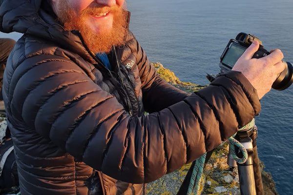
Glengarriff is also where you'll find me a good deal of the time, because the gallery is here, on the main street next to the pharmacy and about a minute's walk from the Blue Pool. If you're doing the peninsula, or coming over the Caha Pass from Kenmare, call in.
If you're reading this from somewhere considerably further away than Glengarriff, everything is on the website too. You can look through the full Cork collection, choose your size and format, and have it shipped wherever you are. If you'd like advice on which image suits a particular wall, or on sizing for a room, get in touch through the contact page and I'll help you work it out.
Either way, in person or from the other side of the world, thanks for coming this far out the peninsula with me.
Cheers,
Peter
Enjoyed this?
Get 12 stories behind Peter's favourite photographs as a free PDF, plus new letters as they're written.
No spam, ever. Unsubscribe anytime.


Leave a comment